White House interference: bad science or poor communication?

deepwater-horizon-smoke-0910-lg.AP.jpg It certainly doesn’t look good. Federal investigators have confirmed that the White House altered a peer-reviewed report last May to expand a six-month drilling moratorium following the Deepwater Horizon oil spill in the Gulf of Mexico. The decision sparked complaints from the peer-reviewers themselves, who said they never signed off on such a recommendation.

A detailed accounting of exactly what happened is included in a new report from the Interior Department’s Inspector General. The document has garnered traction in the press (Politico, AP) and has already been used by at least one senator, Louisiana Republican David Vitter, as evidence that the administration of Barack Obama isn’t making good on its promise to base policies on sound science. The conservative Competitive Enterprise Institute is even calling on Obama to fire his chief energy and climate advisor, Carol Browner.

The inspector general does not assert wrongdoing, however, and the administration (which later apologized) makes a plausible case that it was exercising its right to issue policy after consulting the science. A simple reading of the final report offers some evidence for this. After all, one set of recommendations is clearly attributed to the report (“The report recommends…”) and a second set of recommendations – including the moratorium – is clearly attributed to Interior Secretary Ken Salazar (The Secretary recommends…"). The moratorium is described as a temporary pause that would allow for “implementation of the measures proposed in this report”, and the word “moratorium” doesn’t appear in those detailed recommendations.

Regardless, this technical distinction failed to crystallize in the minds of many. The team that conducted the scientific review had agreed with the secretary’s recommendation for a more limited moratorium and a temporary pause on then-current drilling operations, but the final language recommended a moratorium on all drilling operations (later overturned in by the courts). In their letter (posted here), the reviewers made it clear that they did not agree with the final decision and felt that their names were being used to support it.

What is not at all clear – due to poor editing and/or poor communication – is whether the moratorium was actually part of the report and therefore subject to external review. If not, then it’s actually the peer-review team that is stepping on the policymakers’ toes.

Got Oil?

Posted on behalf of Amanda Mascarelli

A late-breaking session was added to Monday’s schedule at the Geological Society of America meeting in Denver, Colorado, to discuss the status of oil from the Deepwater Horizon spill. The talk, titled “An Update on the Deepwater Horizon Oil Spill: Where is the Oil Now?” aimed to provide an update on how much oil is left in the environment, where it all went, what scientists are doing to find it, and what long-term impacts can be expected.

The main speaker was Dawn Lavoie, Gulf Coast Science Coordinator for the US Geological Survey, who served as the USGS’ ‘boots-on-the-ground’ person during the spill. Lavoie didn’t spend much time answering the questions of how much oil is left and where, since no one really knows yet. Rather, she reiterated the familiar refrain: “There’s still a lot of uncertainty about what’s out there.” Lavoie pointed to the efforts that scientists are making to get at these questions and said that a coordinated effort to sample for oil in sediments has been completed, with the analysis and report set to be released to the public sometime around 6-8 December.

sand berm.jpgPointing to lessons learned from Exxon Valdez, where fresh oil is still found buried in shallow sediments, Lavoie said that “we need to be thinking long-term in terms of decades” for monitoring of impacts and restoration. Lavoie also emphasized that one of the biggest lessons learned in the wake of the disaster was the need to develop – at the federal level – a way to coordinate with the scientific community and to involve scientists in the response and decision-making process immediately following a disaster. “Communication issues were tremendous,” Lavoie says. “The intention was good. I don’t think the follow through was very good.”

Rob Young, a coastal geologist at Western Carolina University in Cullowhee, North Carolina, who introduced Lavoie and took questions from the audience, said that the lack of coordination with scientists meant that local politicians were driving the spill response with almost no input from engineers, geologists, and other experts. Referring to the controversial sand berm project (pictured) to keep oil from reaching fragile marsh and coastline, Young said: “Not only were scientists not involved in planning this massive project, but [the Louisiana governor’s office] was pretty uninterested in scientific feedback.” What’s needed in the future, Young said, is a way to bring scientists to the table very early on to “peer review ideas on the fly”.

Image: Office of Governor of Louisiana

Bat fellatio and slime molds take 2010 IgNobels

It’s that time of year, when a few elite scientists are recognized for years of hard work tackling the great problems of the day. Yes, IgNobel season is upon us.

Unlike the Nobel Awards, which will be divvied out on successive days next week beginning with Medicine and Physiology on Monday, the Igs will be awarded in a single ceremony tonight at Harvard University in Cambridge, Massachusetts. You can watch a webcast of the live ceremony here.

If you’re short on time and only looking for something to talk about at the pub or to procrastinate working on a grant application, here’s a quick rundown of this year’s winners. Highlights include an adaptive explanation for bat fellatio, rollercoaster rides that treat asthma, and the urban planning skills of slime molds.

Engineering – Karina Acevedo-Whitehouse and Agnes Rocha-Gosselin of the Zoological Society of London, UK, and Diane Gendron of Instituto Politecnico Nacional, Baja California Sur, Mexico, for perfecting a method to collect whale snot, using a remote-control helicopter.

Medicine – Simon Rietveld of the University of Amsterdam, The Netherlands, and Ilja van Beest of Tilburg University, The Netherlands, for discovering that symptoms of asthma can be treated with a roller-coaster ride.

Transportation – Toshiyuki Nakagaki, Atsushi Tero, Seiji Takagi, Tetsu Saigusa, Kentaro Ito, Kenji Yumiki, Ryo Kobayashi of Japan, and Dan Bebber, Mark Fricker of the UK, for using slime mold to determine the optimal routes for railroad tracks.

Physics – Lianne Parkin, Sheila Williams, and Patricia Priest of the University of Otago, New Zealand, for demonstrating that, on icy footpaths in wintertime, people slip and fall less often if they wear socks on the outside of their shoes.

Peace – Richard Stephens, John Atkins, and Andrew Kingston of Keele University, UK, for confirming the widely held belief that swearing relieves pain.

Public Health – Manuel Barbeito, Charles Mathews, and Larry Taylor of the Industrial Health and Safety Office, Fort Detrick, Maryland, USA, for determining by experiment that microbes cling to bearded scientists.

Chemistry – Eric Adams of MIT, Scott Socolofsky of Texas A&M University, Stephen Masutani of the University of Hawaii, and BP for disproving the old belief that oil and water don’t mix.

Management – Alessandro Pluchino, Andrea Rapisarda, and Cesare Garofalo of the University of Catania, Italy, for demonstrating mathematically that organizations would become more efficient if they promoted people at random.

Sizing up the spill

<img alt=“spill.jpg” src=“https://blogs.nature.com/news/thegreatbeyond/spill.jpg” width=“312” height=“240” / align="right"> Posted on behalf of Hannah Hoag.

When the government began releasing estimates of the size of BP’s Gulf of Mexico oil well leak, scientists and environmental groups questioned the figures, certain the leak was larger. New research supports that notion. According to the study, published in Science, some 4.4 million barrels of oil has escaped into the ocean. It is the first independent, peer-reviewed paper on the size of the leak. (doi: 10.1126/science.1195840)

Timothy Crone, a marine geophysicist at Columbia University’s Lamont-Doherty Earth Observatory, in Palisades, New York arrived at the estimate using a video analysis technique originally designed to study hydrothermal vents. He had spent years developing optical techniques to measure the flow of the underwater plumes that spew buoyant, superheated mineral-rich water. “Those flows are similar to what we were seeing in the oil flow event, and people were interested in what my estimates would be. People were asking what my estimates were, and I suppose I thought it was my duty,” he says.

Continue reading

Deepwater Horizon: the end of the beginning

deepwater sunset.jpgBP’s Macondo oil well in the Gulf of Mexico was finally shut down on 18 September, as a final squirt of cement sealed the source of America’s largest ever oil spill.
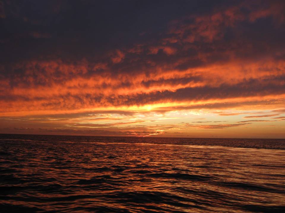
Drilling into the well shaft more than 4,000 metres beneath the sea floor, engineers injected cement into it from below, marking the end of the well which began leaking after the Deepwater Horizon drilling rig exploded and sank in April. Since then it is estimated that around 5 million barrels of oil leaked into the Gulf before the well was capped in July.

“We can finally announce that the Macondo 252 well is effectively dead,” said the National Incident Commander, Admiral Thad Allen (statement). “Additional regulatory steps will be undertaken but we can now state, definitively, that the Macondo well poses no continuing threat to the Gulf of Mexico.”

Deepwater Horizon took nearly five months to completely seal, from the date of the accident. This doesn’t look quite so bad when you compare it to the famous Ixtoc well in the Gulf, which blew in June 1979 and wasn’t capped till March 1980 (see: The lost legacy of the last great oil spill).

Of course, there is still the small matter of those 5 million barrels of oil.

“Our work is not finished, however. BP remains committed to remedying the harm that the spill caused to the Gulf of Mexico, the Gulf Coast environment, and to the livelihoods of the people across the region,” said BP America Chairman and President Lamar McKay (statement).

Image: the Deepwater Horizon wellhead on 29 July / US Coast Guard photograph by Petty Officer 1st Class Adam Eggers.

Oil spill science: A Month Searching for Oil

Posted on behalf of Melissa Gaskill

After 27 days at sea and 80-plus data collection stops, the Cape Hatteras pulled into Gulfport , Mississippi yesterday. Her complement of scientists from the University of Texas Marine Science Institute and the University of Georgia, Athens, broke down the on-board lab, carting instruments and equipment off the ship and into waiting U-Hauls. sample bottles1.jpg

Their research contributed to an aggregate picture that the National Oceanic and Atmospheric Administration (NOAA) is creating of a hydrocarbon signature southwest of the blown well. The data also indicated that waters to the southeast of the well near the Florida shelf remain relatively oil-free, and it created a preliminary picture of hydrocarbon features around the well site. The boxes and cartons carried from the ship contain water samples (right) from across hundreds of kilometers of the Gulf, ready for further testing and analysis.

The Deepwater Horizon created an incredible scientific opportunity, a kind of giant, in-situ experiment. A chance to study, among other things, the long-term movement of oil, mixing and exchange in the water column, and geochemical effects – complex reactions, with multiple variables, taking place in a very large and dynamic system. So far, an impressive array of resources have been deployed to take advantage of that opportunity. The Hatteras, for example, was one of 11 ships stocked with a heck of a lot of scientific instruments and the people to run them.

Continue reading

Oil spill science: Shallower plume found at Deepwater Horizon site

A previously unidentified plume of hydrocarbons approximately 200 meters deep has been discovered by scientists on the R/V Cape Hatteras. The new plume appears to run south and east of the Deepwater Horizon site.

Earlier in the week, the Cape Hatteras collected samples to the west of the main plume, which runs southwest from the well site at about 1,200 meters. A number of research cruises have been collecting data on this plume, which the US National Oceanic and Atmospheric Administration (NOAA) is aggregating onto one grid. But on Thursday last week, the R/V Oceanus, conducting research under the same National Science Foundation (NSF) grant as the Hatteras, reported lower beam transmission, a data signal indicative of increased methane levels and the presence of hydrocarbons, between 200 and 300 meters. The Hatteras steamed more than 10 hours back to where these readings were taken, in the vicinity of the well site, to investigate further. “While I would like to have found the western edge of the main plume we’ve all been mapping,” chief scientist Tracy Villareal said, "this new development was way too exciting not to pursue.”

Continue reading

Oil spill science: On the oil trail

sunset.JPG

Scientists from the University of Texas and University of Georgia aboard the R/V Cape Hatteras have continued mapping subsurface oil this week, collecting data at eight more stations. Chief scientist Tracy Villareal says that the oil plume they are tracking in the Gulf of Mexico is like the summer cloud banks above the ship, constantly moving, expanding, and contracting.

The ship’s Conductivity Temperature Depth (CTD) device relays real-time data measuring fluorescence, beam attenuation, and oxygen levels. A classic oil signature includes a spike in fluorescence accompanied by an increase in beam attenuation and drop in oxygen (see graph). That’s because hydrocarbon particles absorb a fluorescent beam from instruments mounted on the CTD and reflect back a different frequency; the higher concentration of particles in the plume scatter more light (attenuating the beam); while lower dissolved oxygen indicates bacterial metabolism of oil.

The CTD also collects water samples at various depths, and the scientists use these to conduct tests to back up the real-time data. For example, University of Texas graduate student Ellen Knapke measures the amount of bacteria using a flow cytometer and a dye that stains their DNA. The cytometer reads the resulting pigments, counting the number of bacteria present. Although some question the bacterial activity associated with the spill, and its effects on oxygen, higher numbers of bacteria are generally correlated with a drop in oxygen levels. Knapke’s bacteria counts should correlate to the drops in oxygen shown by the CTD, and she reports that they have, consistently.

Continue reading

Oxygen “sags” and oil “snow storm” near spill site

thick-sed-oil300.jpgA new report from the Joint Analysis Group (JAG), which includes the US National Oceanic and Atmospheric Administration, found that oxygen levels have dropped by about 20% below average in locations around the site of the Deepwater Horizon oil spill in the Gulf of Mexico.

In an unrelated development, a team of researchers has found evidence (see photo, right) of precipitated oil on the seafloor below causing significant harm to organisms there.

The zones of depleted oxygen, called “sags” extend some 100 kilometres from the Deepwater Horizon wellhead. The sags are the result of microbial activity breaking down the oil and are not low enough to cause dead zones in the deep ocean, says Steve Murawski, Chief Science Advisor for NOAA Fisheries and head of the joint agency team.

The findings, based on data collected between 8 May and 9 August, dispel questions raised in the JAG’s second report over whether low oxygen signals were simply due to fouled instrumentation. Academic scientists have been documenting significant oxygen drops for months, but the previous JAG report raised concerns that these measurements were “false positives”.

Continue reading

Oil spill science: Mapping subsurface plumes in the Gulf

boat_Cape_Hatteras.jpgThe R/V Cape Hatteras, on a port call after two weeks zig-zagging around the northern Gulf of Mexico on the trail of oil from the Deepwater Horizon spill, seemed quiet when I came aboard Friday afternoon. Some of her eight scientists and technicians (and ten crew members) are enjoying a day off, while others prepare for the next stretch of a 27-day cruise. I watch food and sodas go onto the ship and trash come off, and overhear snatches of cell phone calls home. Chief scientist Tracy Villareal of the University of Texas at Austin contemplates a Google map of the floor of the Gulf.

The existence and location of an oil plume rising from the ruptured well-head has been debated for months (see ‘The mystery of the missing oil plume’ and related stories at Nature’s collection of oil spill stories).

Measurements of hydrocarbons and depleted oxygen at 38 stations on the first leg of the Cape Hatteras’ cruise have already revealed a plume of oil from MC252, better known as Deepwater Horizon. The plume is about 1,000 meters deep, up to several hundred meters thick, and 60 miles long. It extends southwest from the blown well, its movement affected by the Gulf’s complex bottom topography. The data do not indicate oil to the southeast, as predicted by NOAA models, Villareal said.

Continue reading